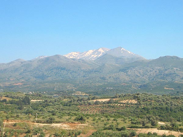
Crete´s highest mountain stands In the middle of the island. It is the Psiloritis - also called the Ida mountain.
The following 10 km, the gravel road winds upwards through formidable hairpin bends.
Psiloritis
|
Αυγή τσ' αυγής θα σηκωθώ με τ' άστρα με φεγγάρι, |
Before dawn I'll wake up to the stars and the moon, | |
|
να πάω να ξημερωθώ εις τον Οψηλορείτη. |
and see the early morning-glow from the peak of Psiloritis. |
|
Crete´s highest mountain stands In the middle of the island. It is the Psiloritis - also called the Ida mountain. |
|
||
|
The massif, covering an area of about 359 km2 consists of several mountain peaks and plateaus - with the Nida plateau as the largest and best known. | ||
| The highest peak is 2.456 m high and can be climbed from either the Nida plateau or from the village of Lochria on the south side. I climbed Psiloritis from Lochria and the following description and photos are from this trip (2004). |
|
||
|
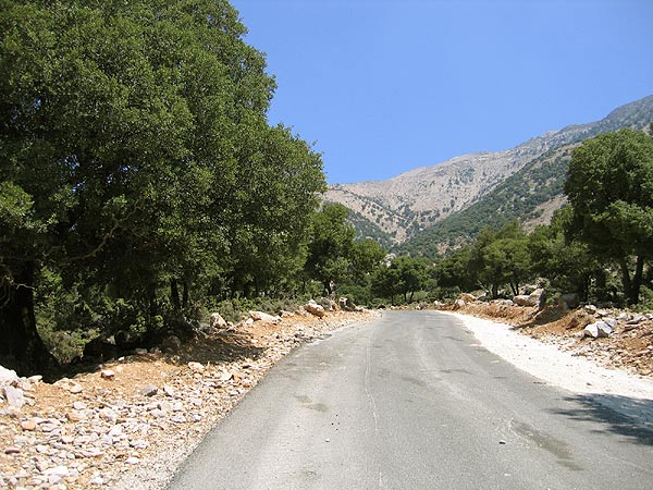
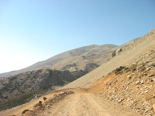
From Lochria a road leads up to Psiloritis. The first four kilometres you go by an asphalted but steep road which then passes into a gravel road - of variable quality. | ||
|
The following 10 km, the gravel road winds upwards through formidable hairpin bends. |
|
||
|
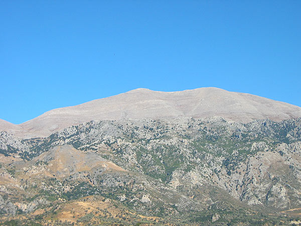
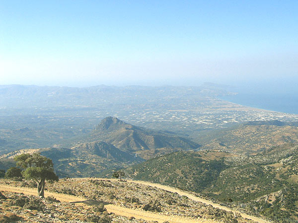
Several places on the way have a magnificent view to Psiloritis with the Timios Stavros church on the top. | ||
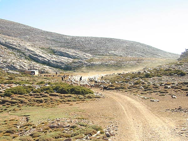
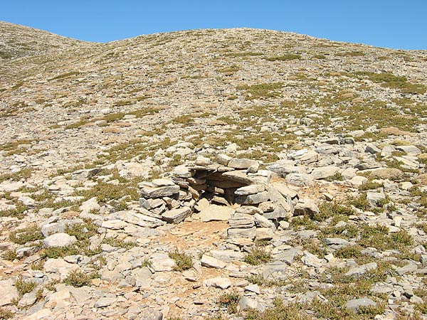
| You also pass by several mitatos - stone huts, where the shepherds stay while taking care of their animals. If you come in the morning you have the opportunity of meeting big flocks of sheep and goats crossing the road on their way to grazing. |
|
||
|
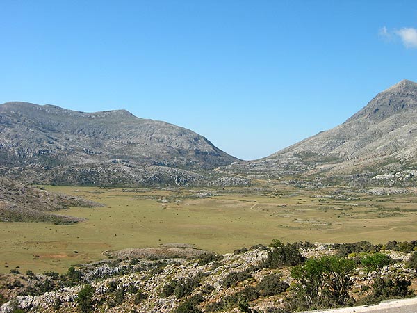
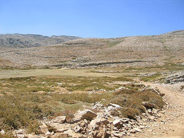
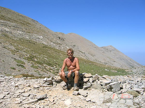
The road ends on the Akollita plateau, and you must walk the rest of the way. To the left of the mitato is a hill and behind that, the path leads to the top. It may be a little difficult to catch sight of but after this, the path is marked by yellow and black arrows - and even with a couple of standard for E4 signs. | ||
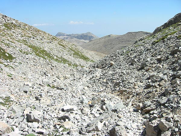
| After an hour of walking, you pass a gorge with a former big landslide. After another 15 minutes of moderate climb you reach a depression in the ground. At this place you should turn and enjoy the view of the two dark peaks of Mavri. |
|
||
|
Having forced this depression, you meet another one where the climb is quite steep. | ||
| You now come to a ridge with a view to the peak of Koussakas (2209 m) to the right. A windbreak offers you an opportunity of finding shelter from the heavy wind. | |||
| During the following half an hour you pass through a flat area, rising however a little towards the end. The reward is waiting at the end: a fabulous view to the peak of Psiloritis and its "appendage" Stolistra (2325 m). |
|
||
|
From here, there is almost another hour of walk to the top. The path winds along the edge of the mountain, and there is an impressive view down over the valley with the villages of the Mylopotamo and Geropotamo areas - all the way down to the coast. | ||
|
|
|||
|
Μαδάρες μου Χανιώτικες, κορφή του Ψηλορείτη |
The White Mountains at Chania, but highest the Psiloritis, | |
| και Λασιθιώτικα βουνά, γεια σου παντέρμη Κρήτη. | and the mountains of Lassithi - hail proud Crete. |
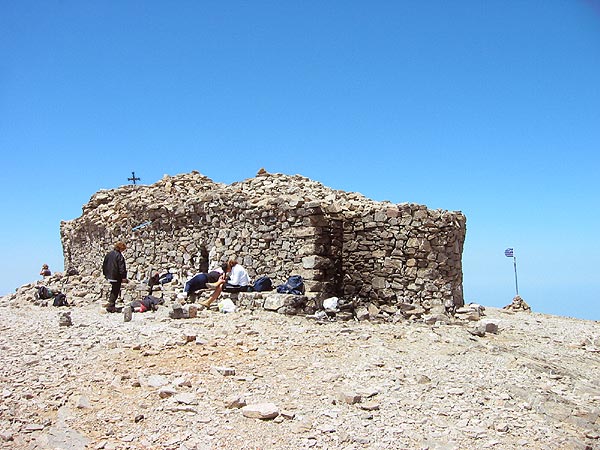
| On the top of Psiloritis stands
a stone church dedicated to Timios Stavros (The Holy Cross). It also
existed in 1893 when Vittorio
Simonelli visited the mountain,
but has later been renovated by the Moundakis family in memory of the late
musician Kostas Moundakis.
|
|
||
| There is of course
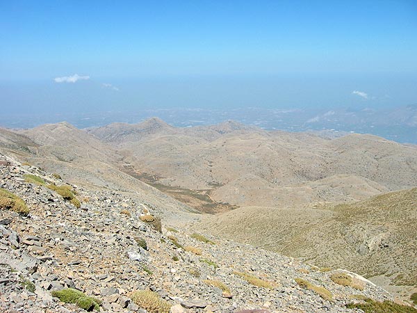
also a breathtaking and magnificent view of Crete:
|
|||
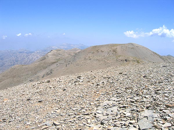 |
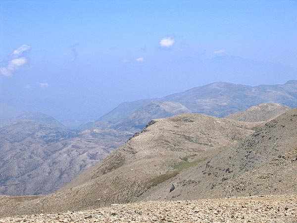
To the east is the summit of Angathias, only 32 m lower than Psiloritis. | ||
| Further out in the horizon on the Skinakas mountain (1752 m), the dome of the observatory reflects the sunbeams, and furthest out in the horizon you can just make out the Lassithi mountains. |
|
||
 |
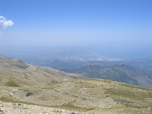
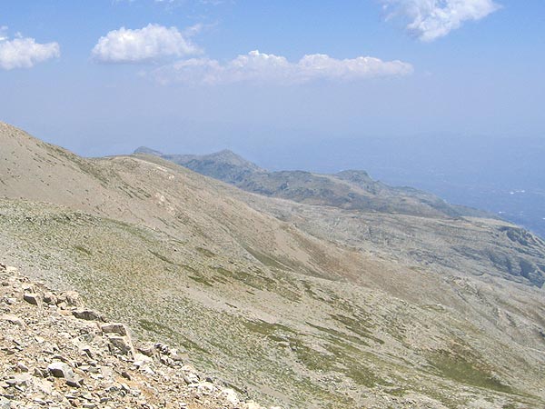
To the north you see Anogia and the other villages all the way down to the coast. The coast itself is however hidden by the elegant peaks of the Kouloukonas mountains. | ||
| To the northwest towers the pointed peak of Stolistra in the immediate vicinity, and there is a formidable view down over Rethymno and Iraklion. Furthest out in the horizon you faintly see the tops of Lefka Ori. |
|
||
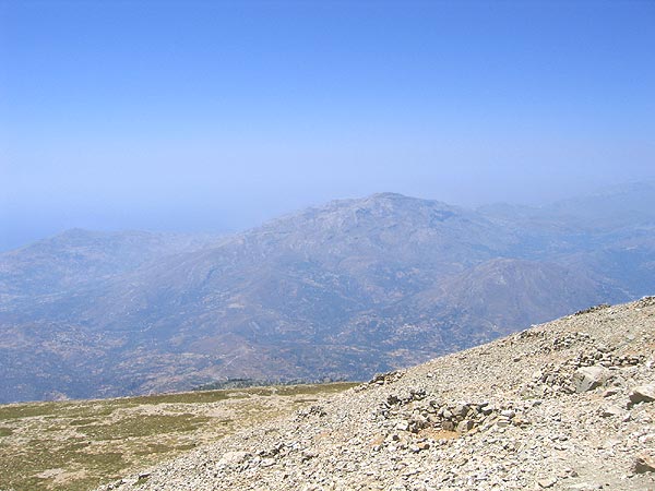 |
To the southwest you see the big Kedros mountain (1777 m) and the Siderotas mountain (1177 m) with its surrounding mountain tops. | ||
| To the south the large fertile Messara plain spreads with the Asterousia mountains as background, and the most southern point of Crete, the Lithino headland with the relatively big Kefala rock. |
|
||
 |
To the south east is the Mavri mountain (1981 m) with its two peaks. The mountain has got its name which means dark, because - when seen from the north - it is considerably darker than the surrounding mountains. | ||
|
|
|||
| Psiloritis is today accepted as a nature reserve in Leader II because of its great natural richness with numerous endemic plants and insects and with the peculiar conduct of life and the unique traditions that the inhabitants of the area have evolved in harmonious co-existence with the mountainous nature. |
|
||
| The nature reserve is split up into four subgroups: | |||
| 1. "Psiloritis" consisting of the actual mountain range. | |||
| 2. "The Cave Reserve", consisting of the most important caves of the area (Idaion Andro, Zoniana, Kamaraki). | |||
| 3. "The Mountain and Plateau Reserve" at the south east slopes of Psiloritis, showing the characteristic transition between mountain and plateau. | |||
| 4. "The Talaia Mountains", consisting of the Kouloukonas mountains at the north coast. | |||